Index of /Nuclear/CNAAA - Central Nuclear Almirante Alvaro Alberto/Angra 3 - EIA/MAPAS_PLANTAS/Volume 2 - Cópia
Name
Last modified
Size
Description
Parent Directory
-
Anaxo01_GeologiaAII50.jpg
26-Jul-2006 11:25
1.2M
Anexo02_GeologiaAID15.jpg
26-Jul-2006 11:25
1.0M
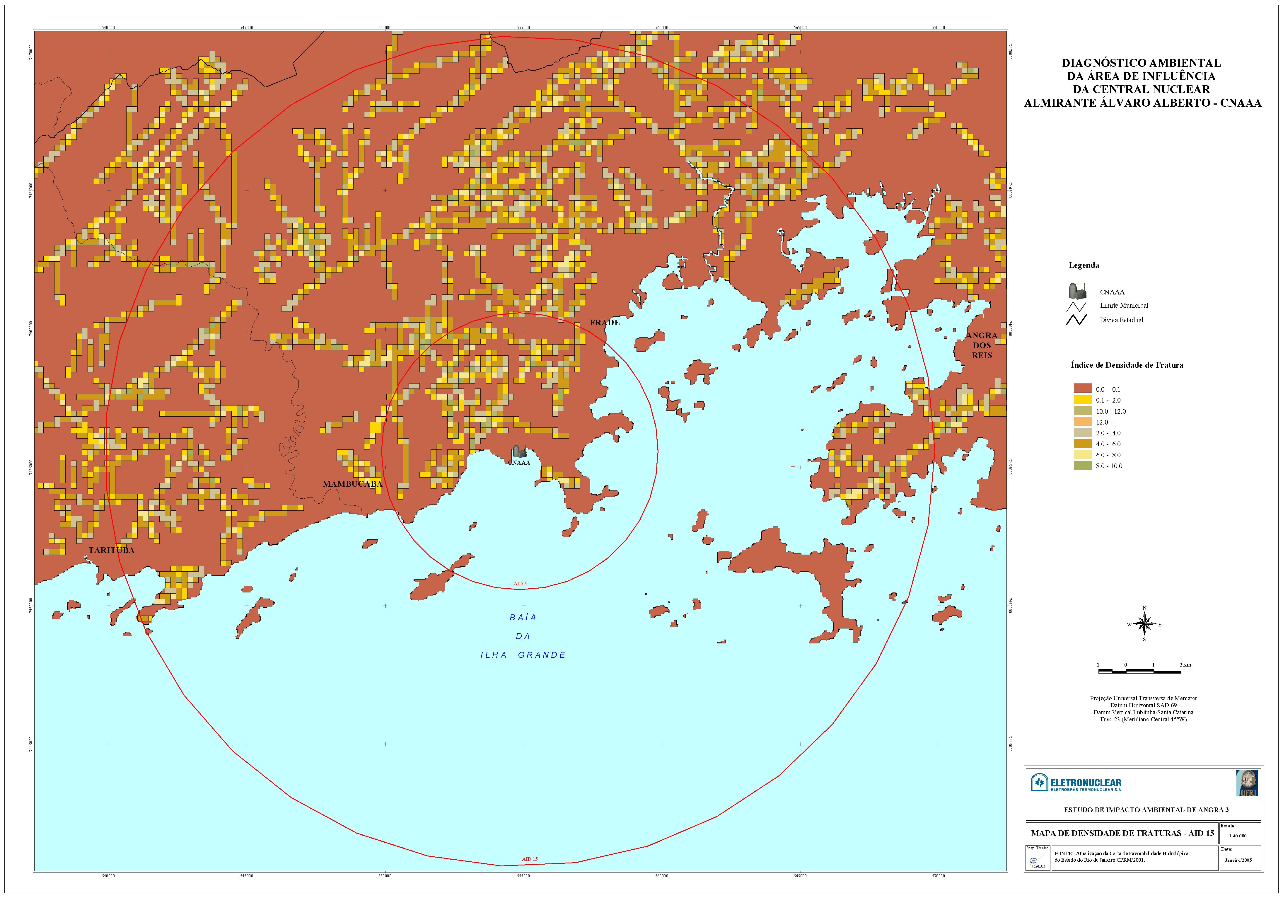
Anexo03_DensFratAID15.jpg
26-Jul-2006 11:25
1.1M
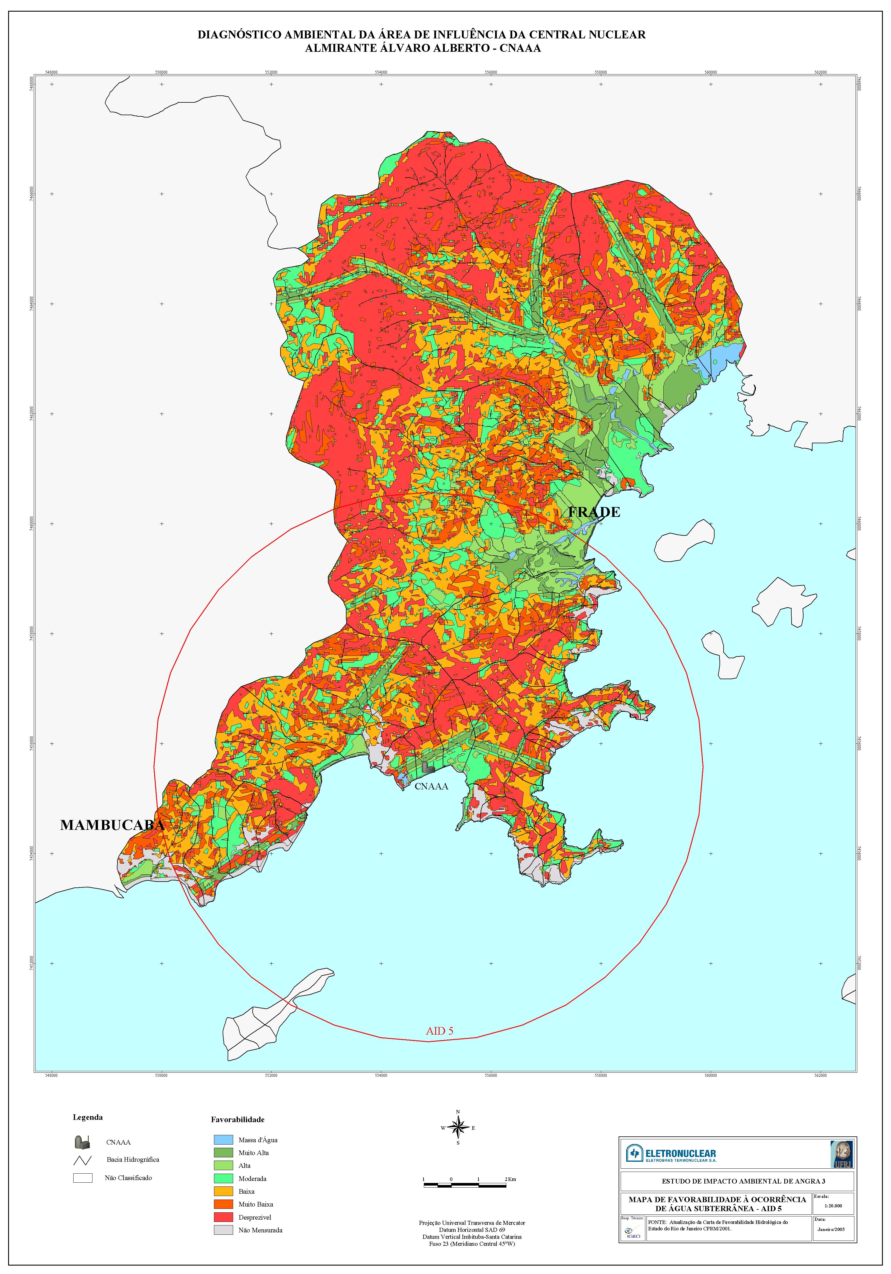
Anexo04_FavorabAID5.jpg
26-Jul-2006 11:25
1.7M
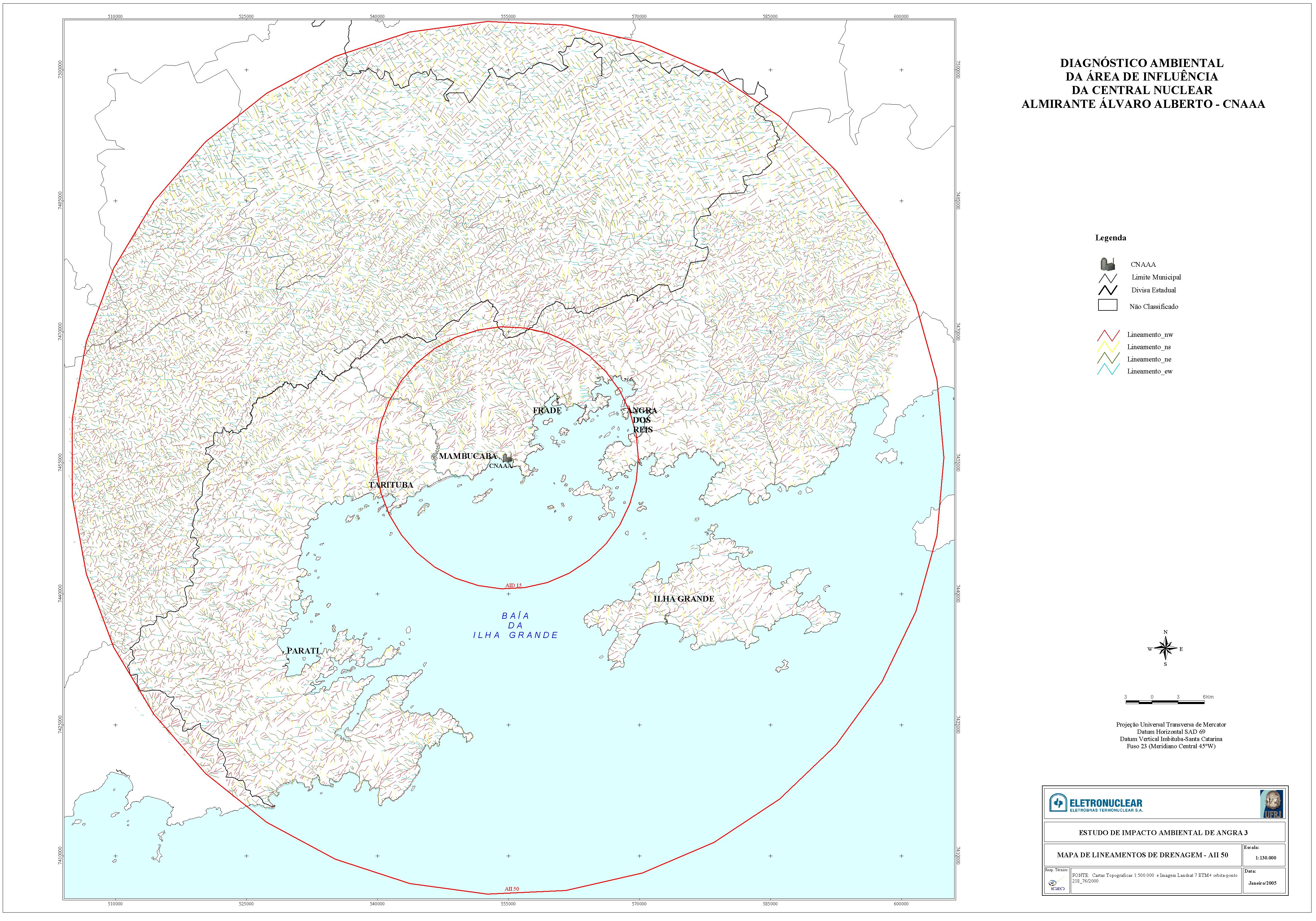
Anexo05_LineamDrenagemAII50.jpg
26-Jul-2006 11:25
2.4M
Anexo06_LineamDrenagemAID15.jpg
26-Jul-2006 11:25
1.2M
Anexo07_Geotecnico.jpg
26-Jul-2006 11:25
2.4M
Anexo08_Perfis_geotecnicos.pdf
26-Jul-2006 11:25
400K
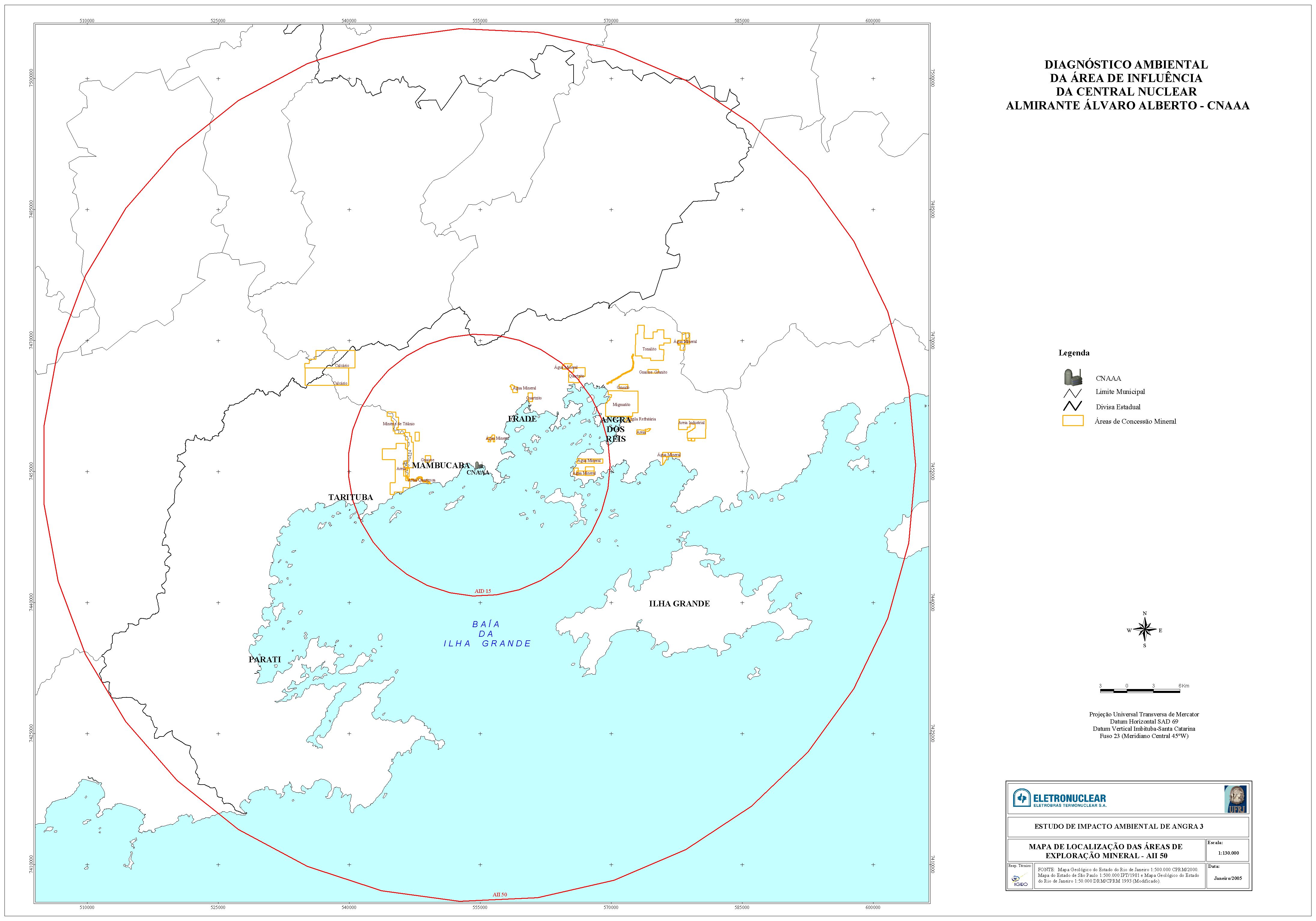
Anexo09_Loc_Expl_Min_AII50.jpg
26-Jul-2006 11:25
822K
Anexo10_AltimetricoAII50.jpg
26-Jul-2006 11:25
2.7M
Anexo11_AltimetricoAID15.jpg
26-Jul-2006 11:25
1.3M
Anexo12_GeomorfologiaAII50.jpg
26-Jul-2006 11:25
1.4M
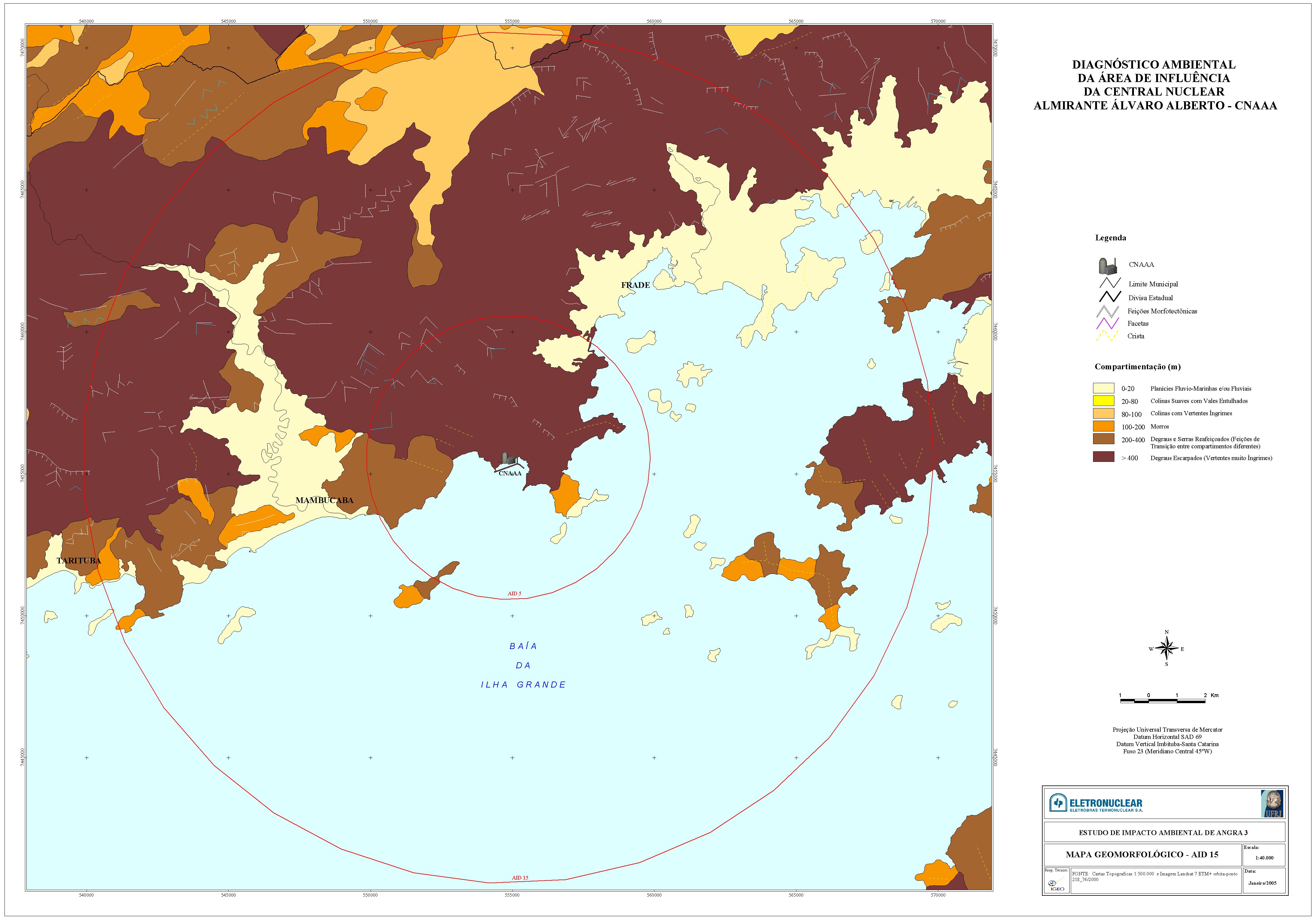
Anexo13_GeomorfologiaAID15.jpg
26-Jul-2006 11:25
918K
Anexo14_DeclividadeAII50.jpg
26-Jul-2006 11:25
2.7M
Anexo15_PedologicoAII50.jpg
26-Jul-2006 11:25
1.0M
Anexo16_PedologicoAID15.jpg
26-Jul-2006 11:25
870K
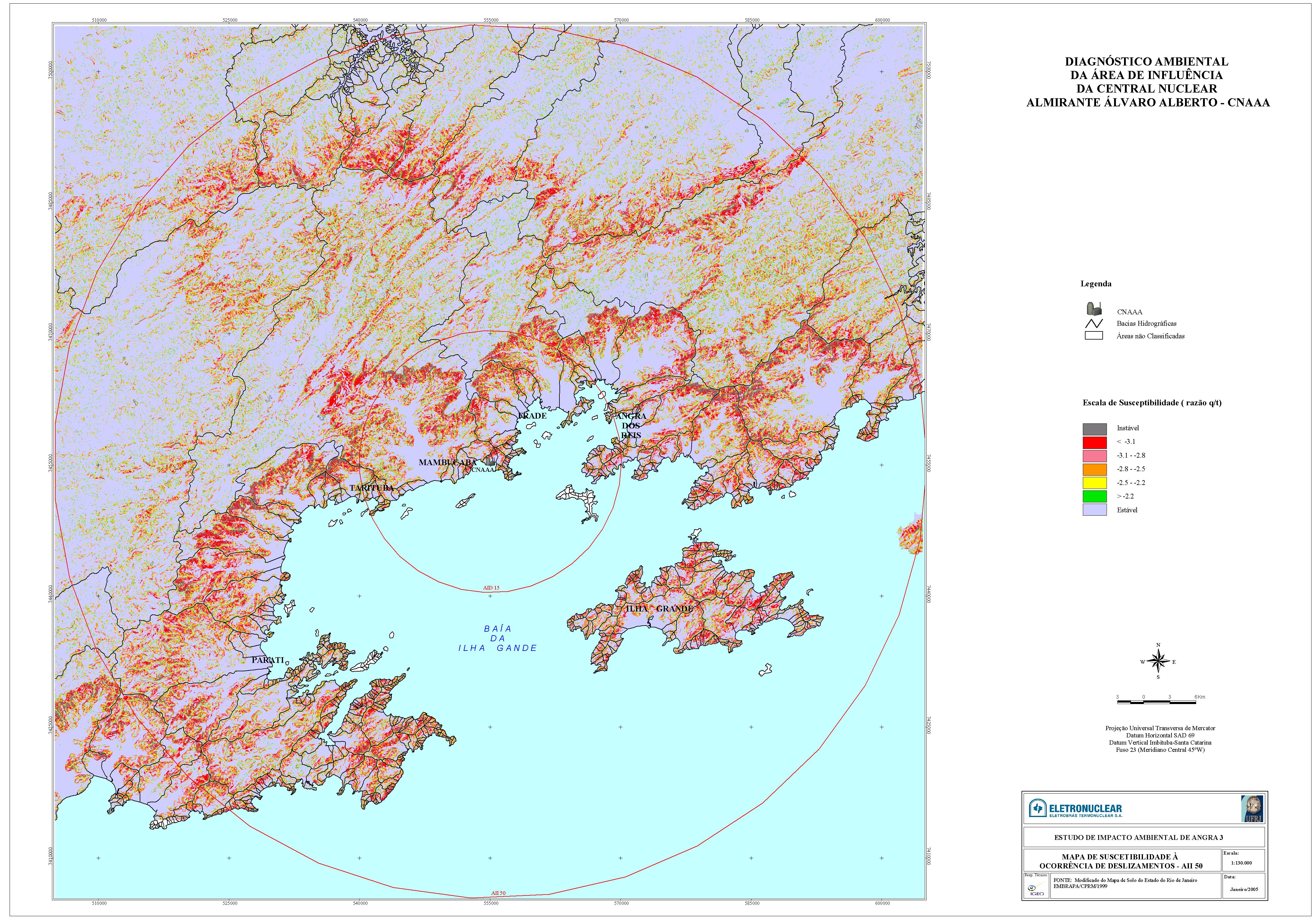
Anexo17_Suscept_Desl_AII50.jpg
26-Jul-2006 11:25
3.1M
Anexo18_Rec_Hidr_AII50.jpg
26-Jul-2006 11:25
2.7M
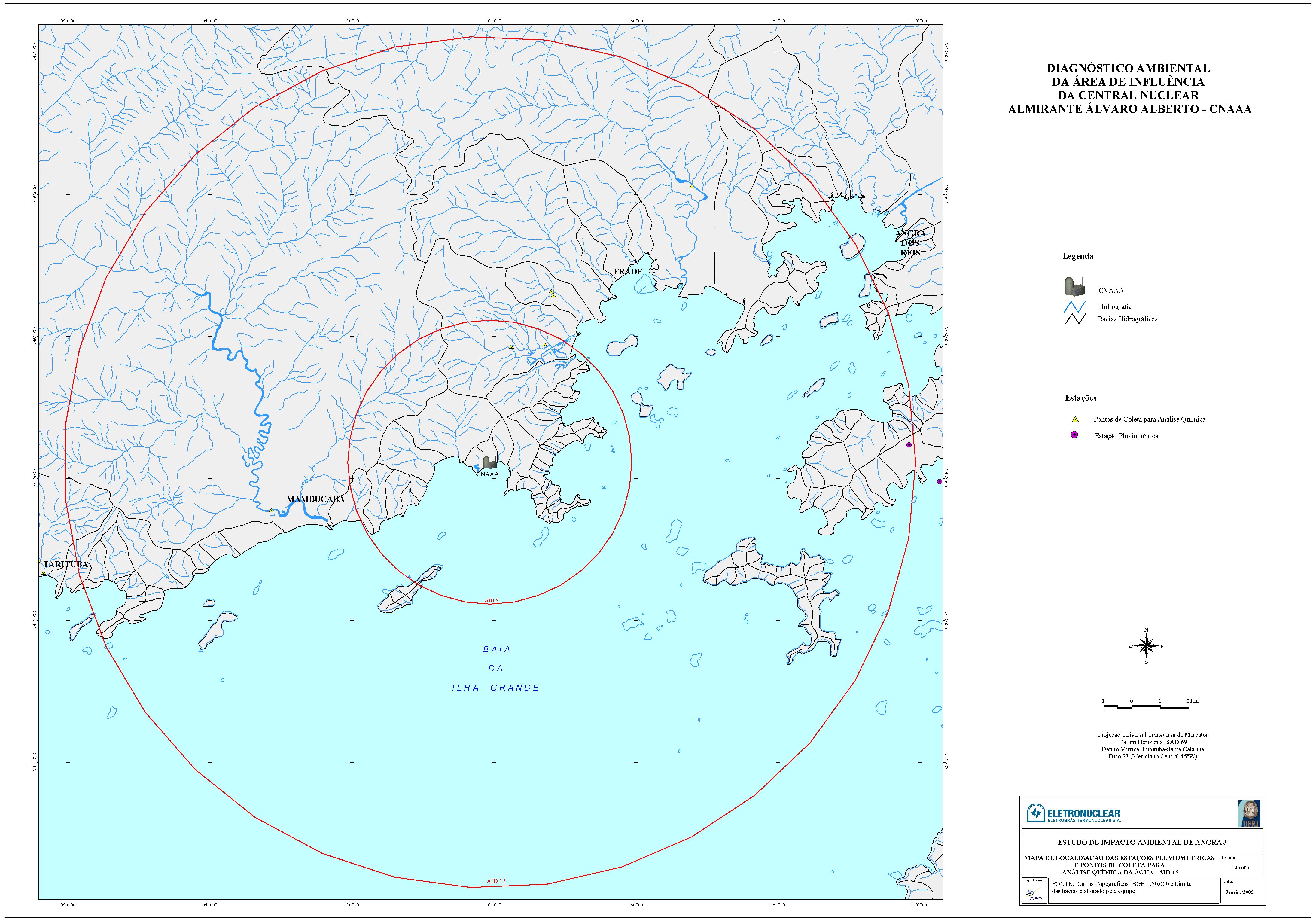
Anexo19_Loc_Est_Pluvi_AID15.jpg
26-Jul-2006 11:25
1.4M
Anexo20_Loc_Est_Pluvi_AII50.jpg
26-Jul-2006 11:25
3.0M
Anexo21_Batim_Posicion1981_perfis_1981_1985.pdf
26-Jul-2006 11:25
61K
Anexo22_Batim_Contorno1981.pdf
26-Jul-2006 11:25
1.0M
Anexo23_Batim_relev_sombra1981.pdf
26-Jul-2006 11:25
1.0M
Anexo24_Batim_gradiente1981.pdf
26-Jul-2006 11:25
1.1M
Anexo25_Batim_posicionam1985.pdf
26-Jul-2006 11:25
83K
Anexo26_Batim_contorno1985.pdf
26-Jul-2006 11:25
800K
Anexo27_Batim_relev_sombra1985.pdf
26-Jul-2006 11:25
1.3M
Anexo28_Batim_gradiente1985.pdf
26-Jul-2006 11:25
1.7M
Anexo29_Batim_compara1981_1985.pdf
26-Jul-2006 11:25
916K
Anexo30_Batim_posicionam_area1_2002.pdf
26-Jul-2006 11:25
101K
Anexo31_Batim_contorno_area1_2002.pdf
26-Jul-2006 11:25
750K
Anexo32_Batim_relev_sombra_area1_2002.pdf
26-Jul-2006 11:25
1.3M
Anexo33_Batim_gradiente_area1_2002.pdf
26-Jul-2006 11:25
1.6M
Anexo34_Batim_posicionam_areas_2002.pdf
26-Jul-2006 11:25
225K
Anexo35_Batim_contorno_area2_2002.pdf
26-Jul-2006 11:26
14M
Anexo36_Batim_relev_sombra_area2_2002.pdf
26-Jul-2006 11:26
14M
Anexo37_Batim_gradiente_area2_2002.pdf
26-Jul-2006 11:26
17M
Anexo38_Batim_posicionam_area3_2002.pdf
26-Jul-2006 11:26
814K
Anexo39_Batim_contorno_area3_2002.pdf
26-Jul-2006 11:26
28M
Anexo40_Batim_relev_sombra_area3_2002.pdf
26-Jul-2006 11:26
28M
Anexo41_Batim_gradiente_area3_2002.pdf
26-Jul-2006 11:26
27M
Anexo42_Granulometria_Localiz_Ptos_Amostrados.pdf
26-Jul-2006 11:26
103K
Anexo43_Granulometria_Distrib_Textural_AREA1.pdf
26-Jul-2006 11:26
903K
Anexo44_Granulometria_Carbonatos_AREA1.pdf
26-Jul-2006 11:26
1.3M
Anexo45_Granulometria_MatOrganica_AREA1.pdf
26-Jul-2006 11:26
1.2M
Anexo46_Granulometria_Areia_AREA1.pdf
26-Jul-2006 11:26
1.2M
Anexo47_Granulometria_Distrib_Textural_AREA2.pdf
26-Jul-2006 11:26
23M
Anexo48_Granulometria_Carbonatos_AREA2.pdf
26-Jul-2006 11:26
252K
Anexo49_Granulometria_MatOrganica_AREA2.pdf
26-Jul-2006 11:26
240K
Anexo50_Granulometria_Areia_AREA2.pdf
26-Jul-2006 11:26
232K
Anexo51_Granulometria_Distrib_Textural_AREA3.pdf
26-Jul-2006 11:26
265K
Anexo52_Granulometria_Carbonatos_AREA3.pdf
26-Jul-2006 11:27
10M
Anexo53_Granulometria_MatOrganica_AREA3.pdf
26-Jul-2006 11:27
8.5M
Anexo54_Granulometria_Areia_AREA3.pdf
26-Jul-2006 11:27
732K
Anexo55_Geofisica_Posicionam_Linhas.pdf
26-Jul-2006 11:27
734K
Anexo56_Geofisica_ContornoEstrutural.pdf
26-Jul-2006 11:27
1.2M
Anexo57_Geofisica_Isopacas_Megaseque01.pdf
26-Jul-2006 11:27
1.2M
Anexo58_Geofisica_Isopacas_Megaseque02.pdf
26-Jul-2006 11:27
1.2M
Anexo59_Geofisica_Isopacas_Megaseque03.pdf
26-Jul-2006 11:27
1.2M
Anexo60_Geofisica_Isopacas_LAMA.pdf
26-Jul-2006 11:27
1.2M
Anexo61_Geofisica_Isopacas_TOTAL.pdf
26-Jul-2006 11:27
1.2M
Thumbs.db
19-Aug-2014 11:39
81K